Geostationary satellites are those that orbit the Earth's equator at the same speed as the Earth.
These satellites meet several basic standards, for example: an altitude of 36,000 kilometers, as this balances the Earth's centrifugal force. Furthermore, they must rotate in sync with the Earth's motion. This is why the distance they are located is very important, otherwise they could be ahead or behind.
We see the solutions they offer in our everyday lives, but they are also essential for the vast majority of companies around the world. Thanks to satellite antennas, we can communicate from different locations on Earth.
The first geostationary satellite was Syncom 3, which was launched from Kennedy Field in 1964. The launch of this experimental satellite allowed for communications testing and covered the 1964 Tokyo Olympics for live television. Originally a NASA-only program, it became the world's first geosynchronous and geostationary communications satellite in 1961.
If a satellite travels at high speeds, its centrifugal force can overcome Earth's gravity, and it can be knocked out of orbit and lost in space.
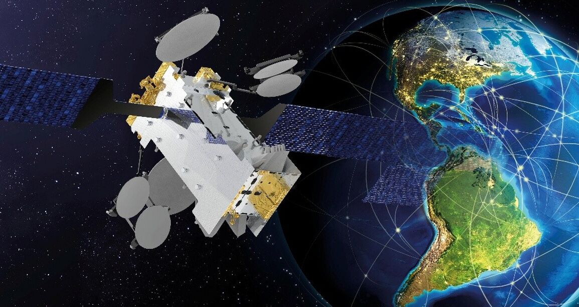
To name one of the most modern geostationary satellites in the world, Hispasat's Nexus satellite is a high-performance geostationary satellite aimed at the air and maritime mobility market, which will also enable high-quality internet access in locations as remote as Greenland and the Amazon rainforest. This high-performance geostationary satellite will enable high-speed internet access throughout the Americas, the North and South Atlantic corridors, and locations as remote as Greenland and the Amazon rainforest. It is specifically designed to offer high-quality connectivity on airplanes and ships and will effectively contribute to bridging the digital divide in Latin America in an agile and efficient manner.
Technological Innovation
This new satellite represents a technological advancement that strengthens Hispasat's position at the forefront of the satellite industry and features a state-of-the-art Digital Transparent Processor (DTP). It enables single-hop communications across its entire coverage area and provides maximum flexibility, making it easier to adapt to changes in service demand over its more than 15-year lifespan.
Satellite Overview
In astronomy, a satellite is an object that orbits another, larger object. There are two types of satellites: natural and artificial. Regarding the former, there are several hundred natural satellites in our Solar System alone. The best known is the Moon.
Very complex artificial satellites orbit Earth's atmosphere, created by humans for various purposes, such as:
• Sending and receiving mass communications, such as telephone, television, or the Internet.
• Making weather forecasts.
• Providing educational and healthcare services in areas inaccessible to more traditional technologies.
However, when we refer to artificial satellites, we are talking about any non-natural object orbiting a celestial body. These objects usually have a specific purpose, such as: better understanding the universe, communications, meteorological matters, remote sensing, navigation, reconnaissance, among others.
Some satellites have even been launched into space for military and scientific research purposes. Most artificial satellites orbit planet Earth. They play a significant role in the development of human technology, and today we could hardly live without them.
Types of Satellites
There are several basic types of artificial satellites orbiting the Earth: geostationary satellites and polar satellites.
• Geostationary: These satellites move in an east-west direction above the equator. They follow the direction and speed of the Earth's rotation.
• Polar: These are so-called because they travel from one pole to the other, in a north-south direction.
Within these two basic types, there are some types of satellites that are responsible for observing and detecting the characteristics of the atmosphere, oceans, and land masses. They are considered environmental satellites. They can be divided into several types, such as geosynchronous and sun-synchronous. The former orbit the planet at the same speed as the Earth's rotation. The latter pass over a specific point on the planet at the same time each day. Most satellites used in telecommunications and weather forecasting are geosynchronous.
Artificial satellites must be launched into orbit by some type of space launch, which, once the desired atmospheric region is reached, abandons the device forever. Although there are hundreds of possible orbits, satellites generally follow three types of trajectories:
• Low Earth Orbit: between 700 and 1,400 km altitude, with an orbital period of 80 to 150 minutes.
• Medium Earth Orbit: between 9,000 and 20,000 km altitude, with an orbital period of 10 to 14 hours.
• High Earth Orbit: at an altitude of 37,786 km above the Earth's equator, with an orbital period of 24 hours above the same location on the planet.
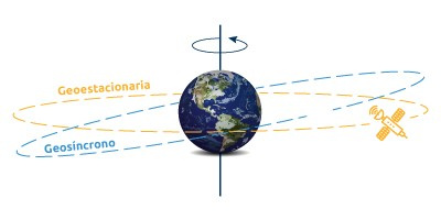
Geostationary Satellite Orbit
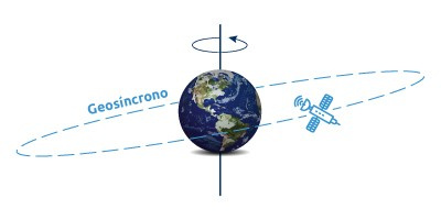
There is an optimal point above Earth where a satellite can coincide with the Earth's rotation. This special position in high Earth orbit is known as a geosynchronous orbit. But how does this differ from a geostationary orbit?
Geosynchronous Orbit
At approximately 35,786 kilometers above the Earth's surface, satellites are in geostationary orbit. From the center of the Earth, this is approximately 42,164 kilometers. This distance places it in the high Earth orbit category.
At any inclination, a geosynchronous orbit is synchronized with the Earth's rotation. More specifically, the time it takes for the Earth to rotate on its axis is 23 hours, 56 minutes, and 4.09 seconds—the same time as a satellite in a geosynchronous orbit.
If you are an observer on the ground, you would see the satellite as if it were in a fixed, motionless position.
This makes geosynchronous satellites especially useful for telecommunications and other remote sensing applications.
Geostationary Orbit
While geosynchronous satellites can have any inclination, the key difference from a geostationary orbit is that they are in the same plane as the equator. Geostationary orbits fall into the same category as geosynchronous orbits, but are stationed over the equator. This special quality makes geosynchronous orbits unique.
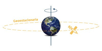
While the geostationary orbit is in the same plane as the equator, geosynchronous satellites have a different inclination.